Montenegro – that means black mountains, and it is these very mountains that draw us to the small Adriatic country in May and June 2022. During our two-week Montenegro road trip, we want to explore the country on our own with the camper.
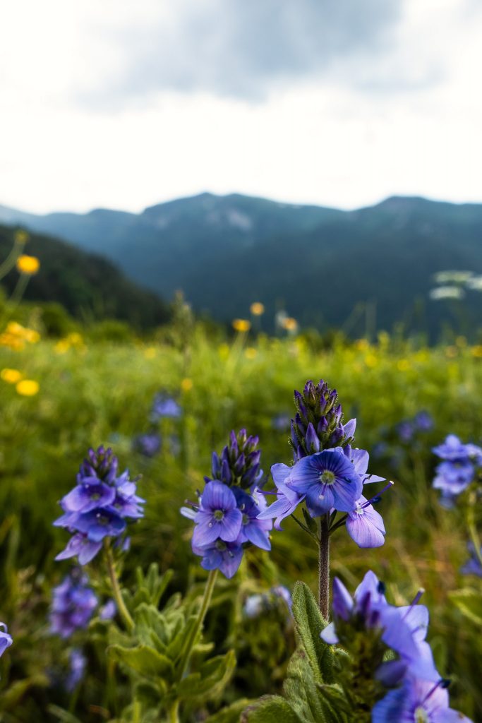
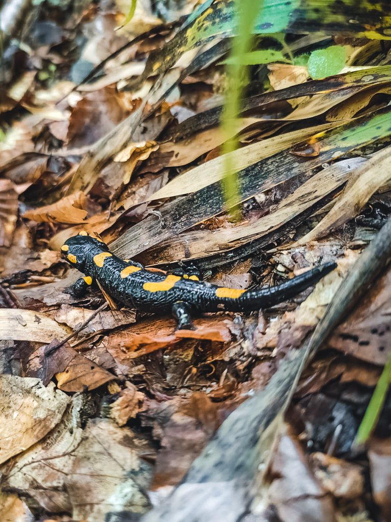
With 13,812 km², Montenegro is one of the smaller countries in Europe, yet it offers an impressive variety of landscapes. On one hand, there are breathtaking coastal landscapes with charming seaside towns that invite you to relax with a glass of wine. On the other hand, there are rugged mountain ranges with spectacular views, sparkling glacial lakes, and the second deepest canyon in the world. With five national parks, Montenegro also offers a stunning diversity of plants and animals. Therefore, on a road trip through Montenegro, there is plenty to discover, and it can be especially well-explored with a camper van.
In this article
From the Bay of Kotor to the Durmitor National Park
Within a week, we drive through Switzerland, Italy, and Croatia along the coast to Montenegro. After crossing the border, we are drawn to the seclusion of the mountains. The coast seems too hot and crowded, although beautiful.
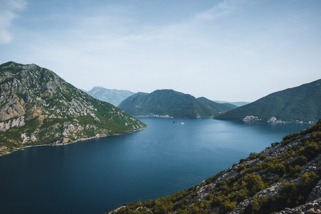
Die Bucht von Kotor ist auf allen Seiten von Bergen umgeben, die steil vom Meer hinausragen. Wir starten unseren Roadtrip durch Montenegro damit, die vielen Serpentinen, die sich hier vom Meer nach oben schlängeln, zu erklimmen. Bereits nach nur wenigen Minuten Fahrt bietet sich uns eine atemberaubende Aussicht über die Bucht von Kotor.
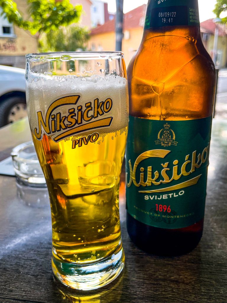
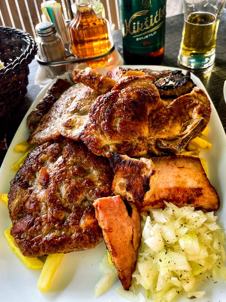
Dinner in Nikšić – or our first encounter with Montenegro's huge food portions
It is 6:00 PM as we drive through Nikšić. Time for dinner. The guidebook praises a small restaurant as having the best grilled meat in town. The decision is easy. We don't understand much on the menu, but the friendly owner recommends one of his mixed grill plates. "Perfect for two hungry travelers." The portion, consisting of meat and potatoes, would easily satisfy four hungry travelers. To the cook's amazement, we manage to eat just two-thirds. It was our first encounter with the large portions in Montenegro, but certainly not the last. It was not uncommon during our trip to see portion sizes like "1kg of lamb," "600g of fish," or "800g mixed platter" on the menus.
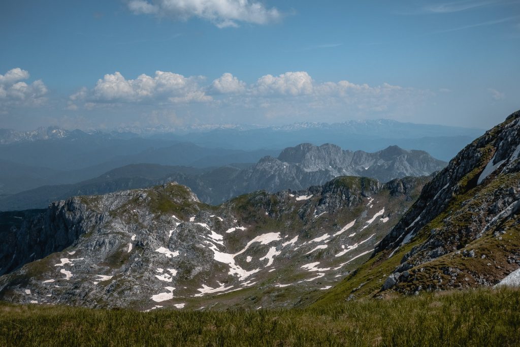
Durmitor Nationalpark
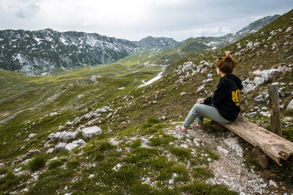
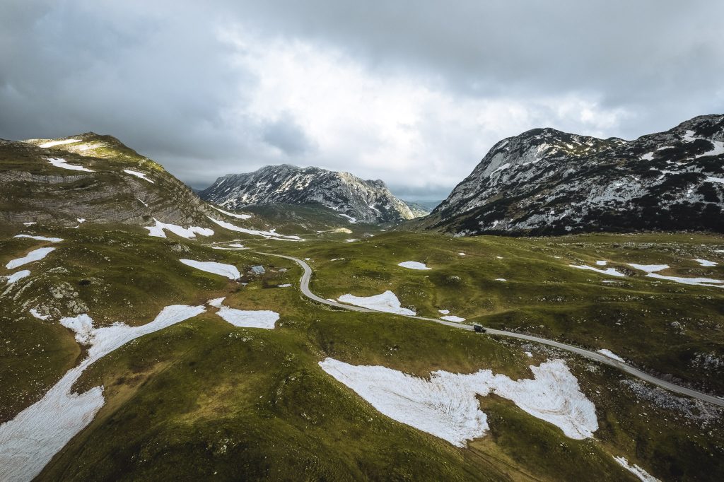
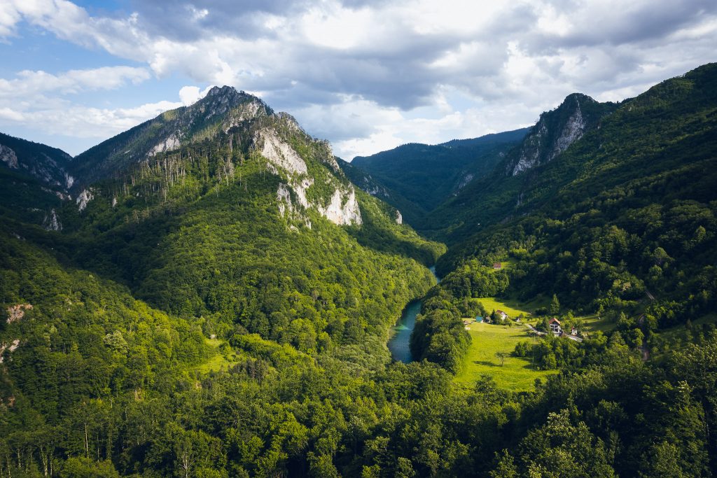
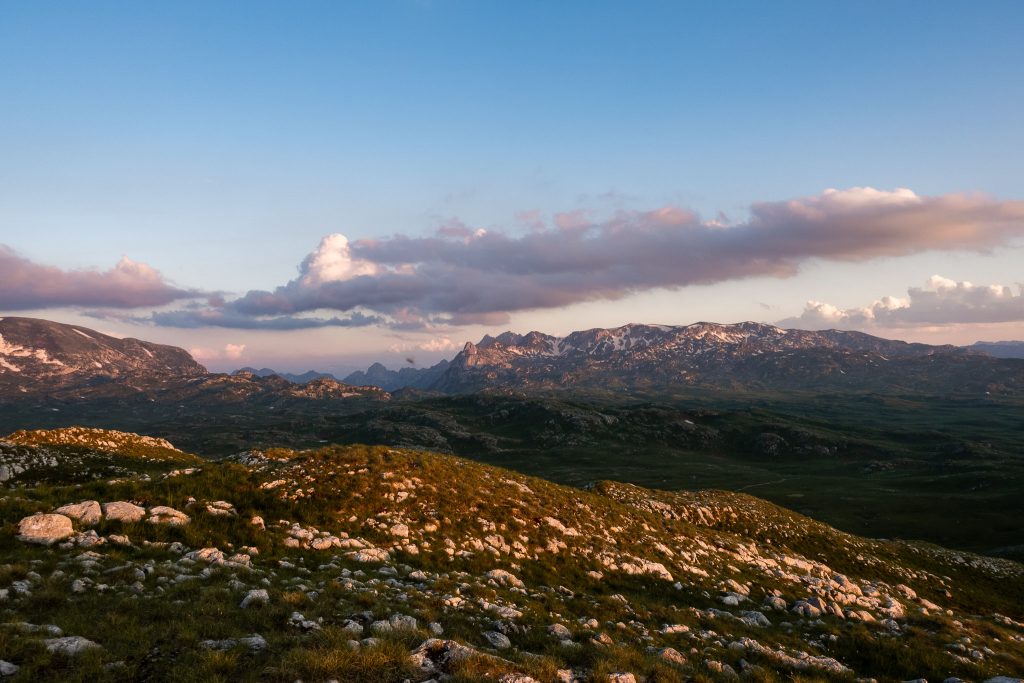
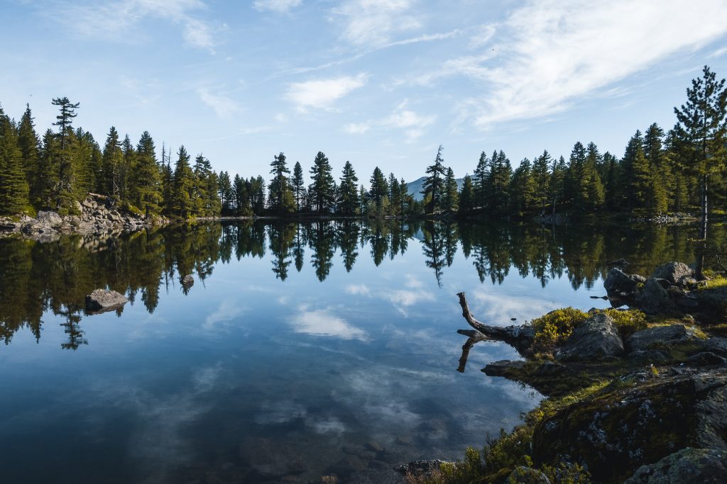
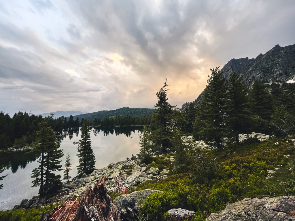
Durmitor boasts 49 peaks over 2000 meters, with Bobotov Kuk being the highest in Montenegro at 2,523 meters. Eighteen mountain lakes are spread across an area of 39,000 hectares, and the park also protects Europe's deepest gorge – the Tara Gorge. It is these numbers and facts that make the Durmitor National Park an appealing first stop on our Montenegro trip. Our starting point is Žabljak. From there, countless excursions into the park are possible. Additionally, it is a good starting point to get a first impression of the park on the Durmitor Ring, Montenegro's most famous panoramic road.
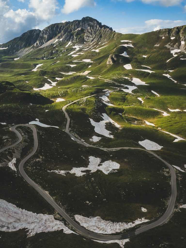
The Durmitor Ring – one of the most beautiful panoramic roads in Montenegro
In 78 km, the Durmitor Ring winds around the rugged peaks of the national park. The driving time is listed as 3 hours – we already spend the entire day on the first half of the ring. And not because the road is in poor condition, but because a spectacular view awaits us around every corner, making us stop in awe. We keep stopping, hiking a bit up the mountains, or enjoying the view swith a coffee.


Towards the end of the day, thick fog rolls in, limiting our visibility to just a few meters. We are allowed to spend the night on the meadow across from a guesthouse. It rains all night long.
Even the following morning, the weather hardly improved. Therefore, we are much faster on the second half of the ring road. We can only imagine the spectacular views of the Durmitor peaks and the Tara Gorge.
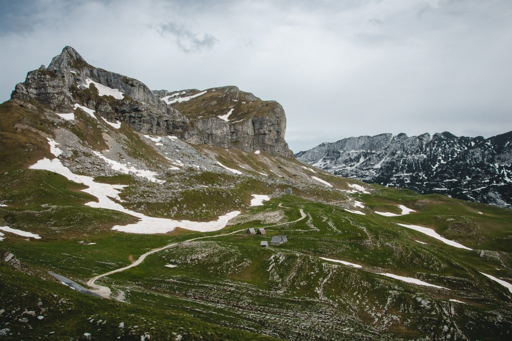
Hiking up the Jablan Jezero and Crvena Greda
The next day, we put on our hiking boots for a short hike to Lake Jablan Jezero and from there continue up the mountain to the viewpoint Crvena Greda. The path to the lake is easy and mostly well-marked. The trail up to the viewpoint is hard to miss. Even halfway through, this hike offers spectacular views of the surrounding peaks. Apart from a short, worn-out section, the hike is easy and highly recommended if you have little time but are looking for a rewarding hike.
Rafting in the Tara Gorge
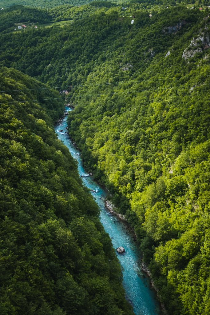
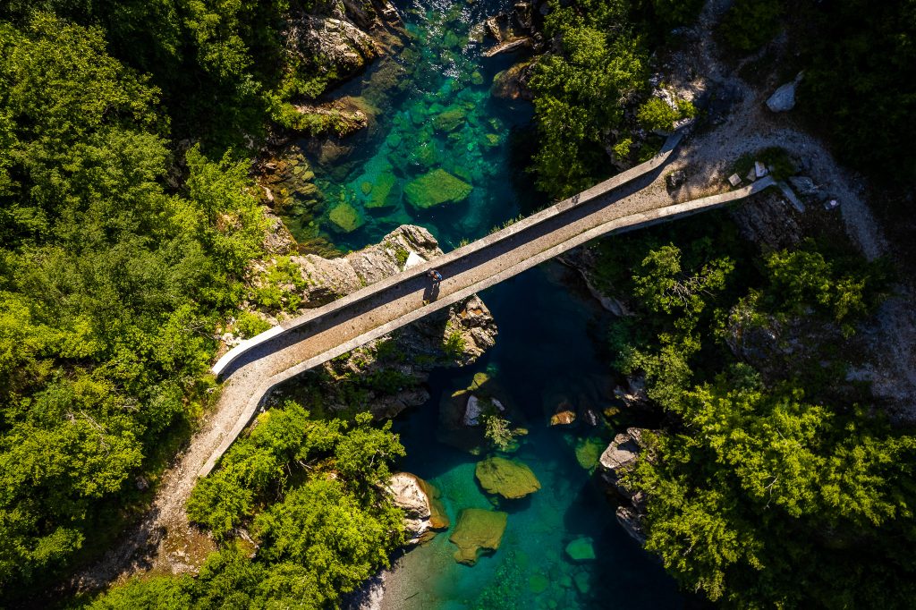
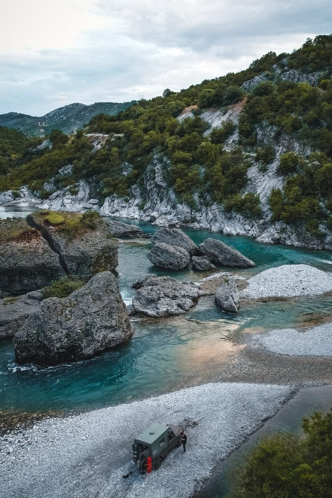
The Tara River winds 140 kilometers through Montenegro, making it the longest river in the country. However, it is mainly famous for its spectacular gorge. Everyone knows the Grand Canyon, most know the Verdon Gorge, but few are aware of the Tara Gorge, despite it being the deepest gorge in Europe and the second deepest in the world after the Grand Canyon in the USA. At its deepest point, the gorge is up to 1300 meters deep. The steep cliffs are so precipitous that you can only descend into the gorge on foot at very few points. The best way to explore it is therefore on the water.
Along the river, there are several rafting camps on both sides. The Rafting World Championships were held here in 2009 and again in 2022. When choosing, we followed the recommendation from the guidebook and booked our tour with Waterfall Rating The good Google reviews convinced us, as well as the location right by the river. The rafting package included breakfast and lunch, along with a very friendly and competent team, and of course, lots of fun.
After breakfast, we receive our equipment – wetsuit, life jacket, and dry bag. We are driven to our entry point on the Tara in an old Land Cruiser. Marco, our guide, explains how to hook our feet into the loops in the raft to avoid falling out. He explains how to paddle and what to do if we can't stay in the raft. He explains with the necessary seriousness but without making us afraid. And then we are sitting, eight of us, in our raft and paddling off. The first two rapids are quite challenging. For a moment, I wonder what I have gotten myself into, but then the fun takes over. Marco guides us safely through the rapids and back to our camp. Rafting was incredibly fun, but what impressed us most was the gorge, the untouched nature, and the turquoise water.
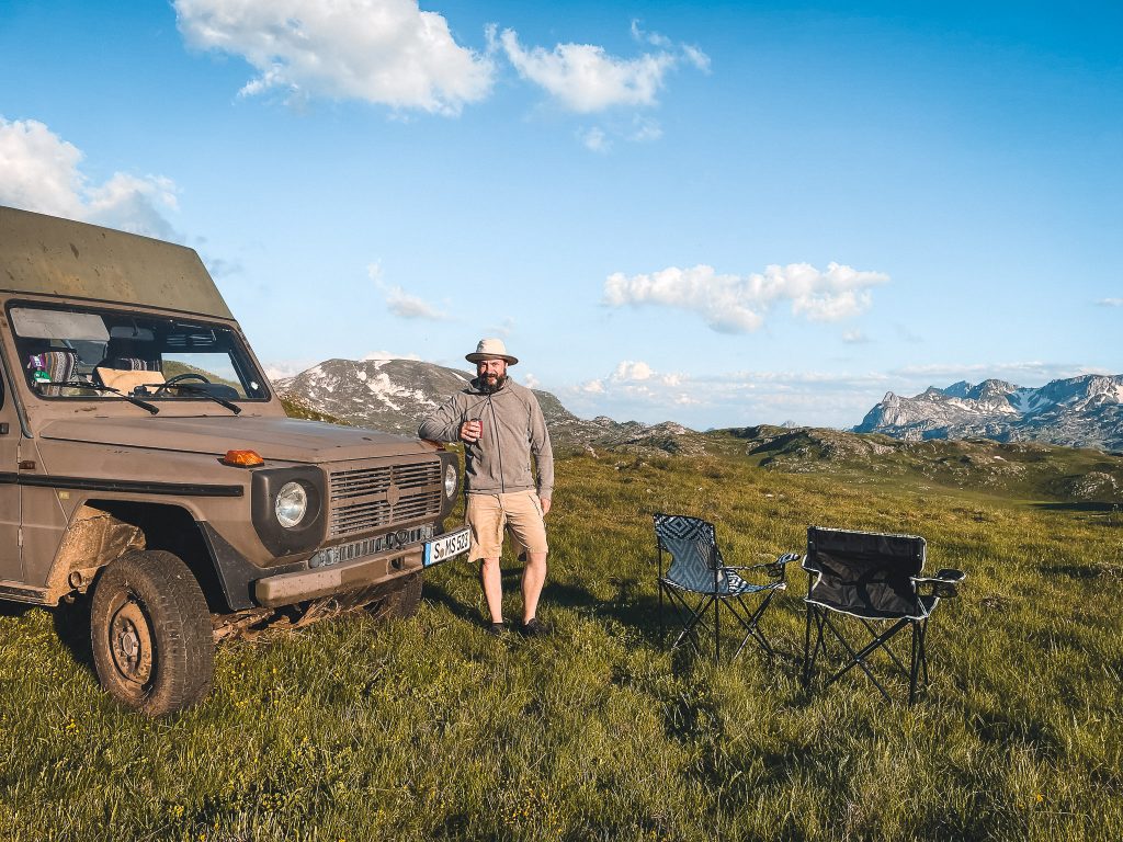
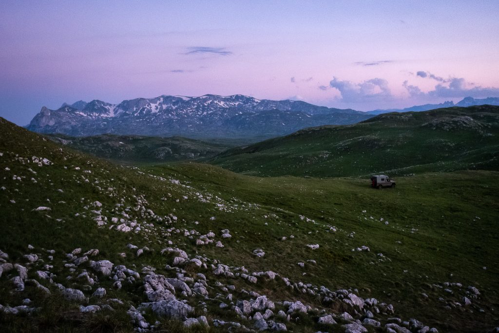
Sinjajevina
Nature, tranquility, and alpine farms
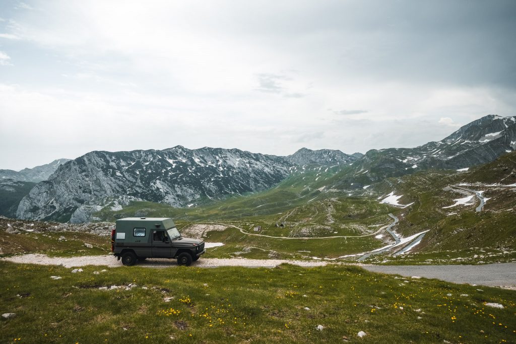
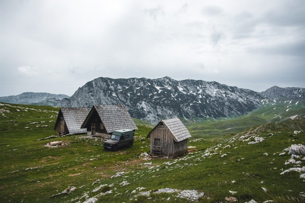
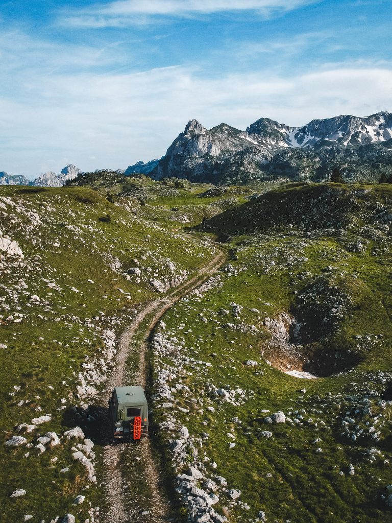
I don't exactly remember how I found this dreamy spot. But at some point during our trip preparations, I must have placed this green flag on Google Maps marked "I want to go here." On Google Satellite, the road looks promising – winding and small – just our taste. When the serpentine road changes from asphalt to gravel, we know it was the right decision to take this road.
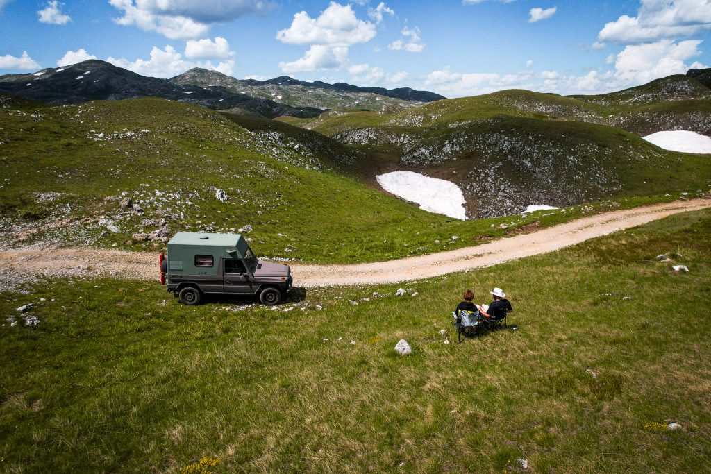
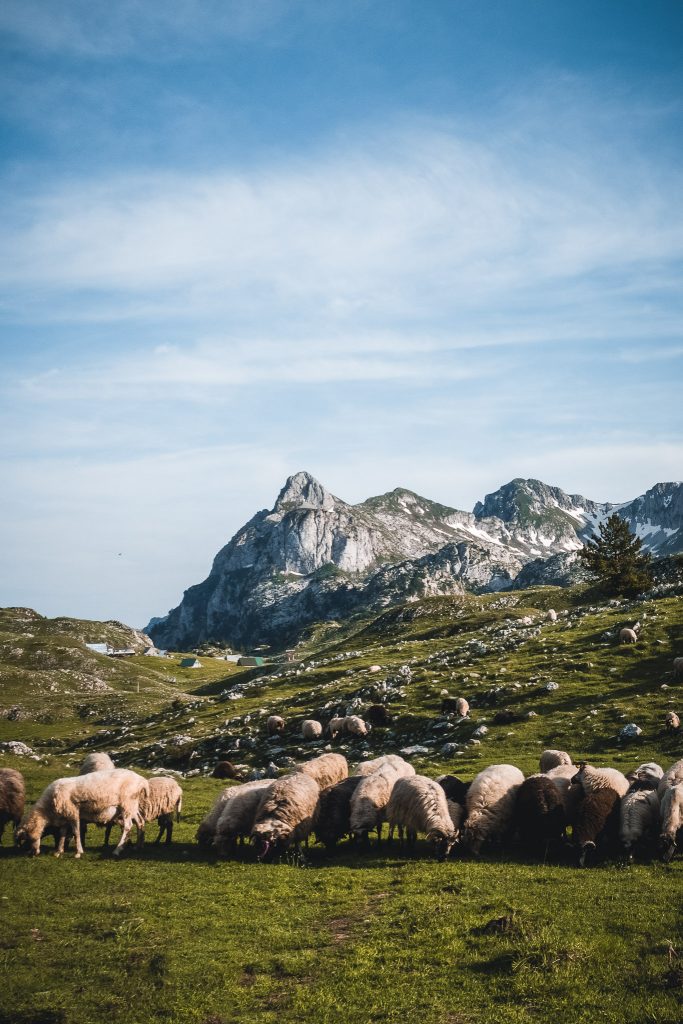
The area extends over 1600 meters, 40 km long and 15 km wide, near Durmitor National Park. In the summer, farmers still bring their sheep and cows up here to spend the summer months, shaping the image of Sinjajevina along with the unique landscape.
We set up our camp near one of these small farms, and with a short "hello" and using hand gestures, we get the okay to spend the night in the meadow. Our evening walk takes us up the next mountain. It's just a few hundred meters to the summit. It welcomes us with the most impressive view of our entire trip. And all this by chance or fortunate happenstance.
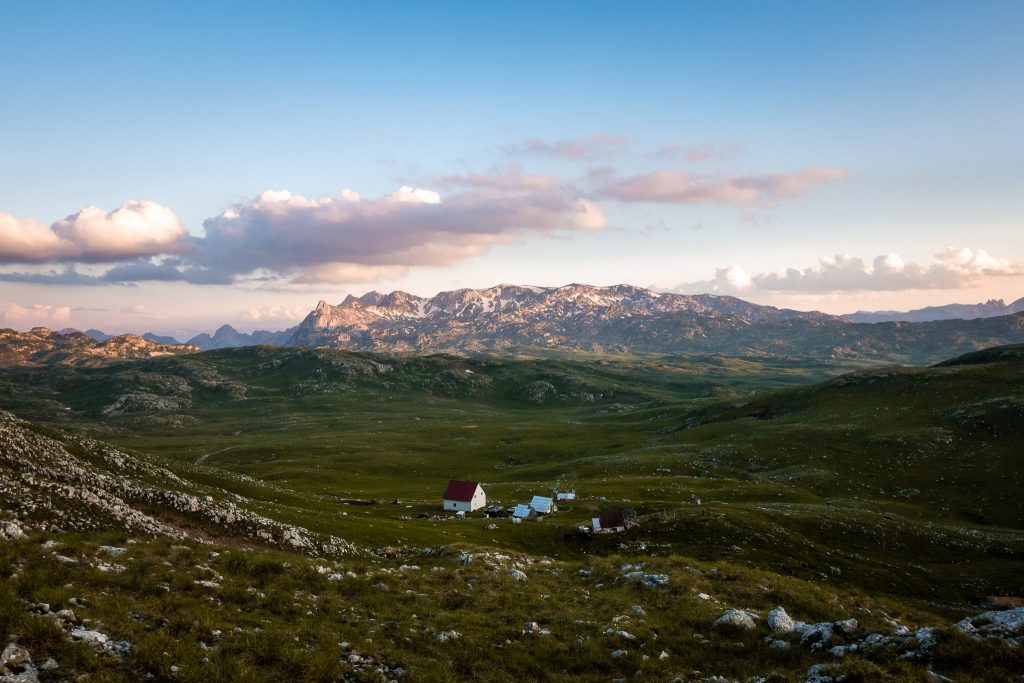

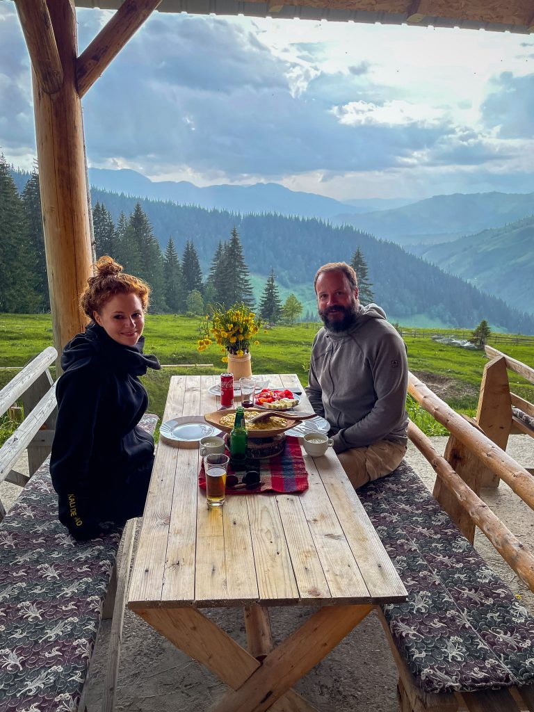
The next day, we continue our journey to Kolašin. Just a few kilometers further, we come across a sign that says "Homemade Food and Accommodation." So, we quickly turn off towards the farm. The conversation takes place with hand gestures and a few words from the guidebook. The result is a huge breakfast consisting of an entire loaf of bread, thick slices of Prošut – a homemade smoked beef ham, homemade cheese, and a cup of sour milk. To our hostess's amazement, we can't finish everything that was served. She quickly makes us a few sandwiches from it and packs them for our onward journey.
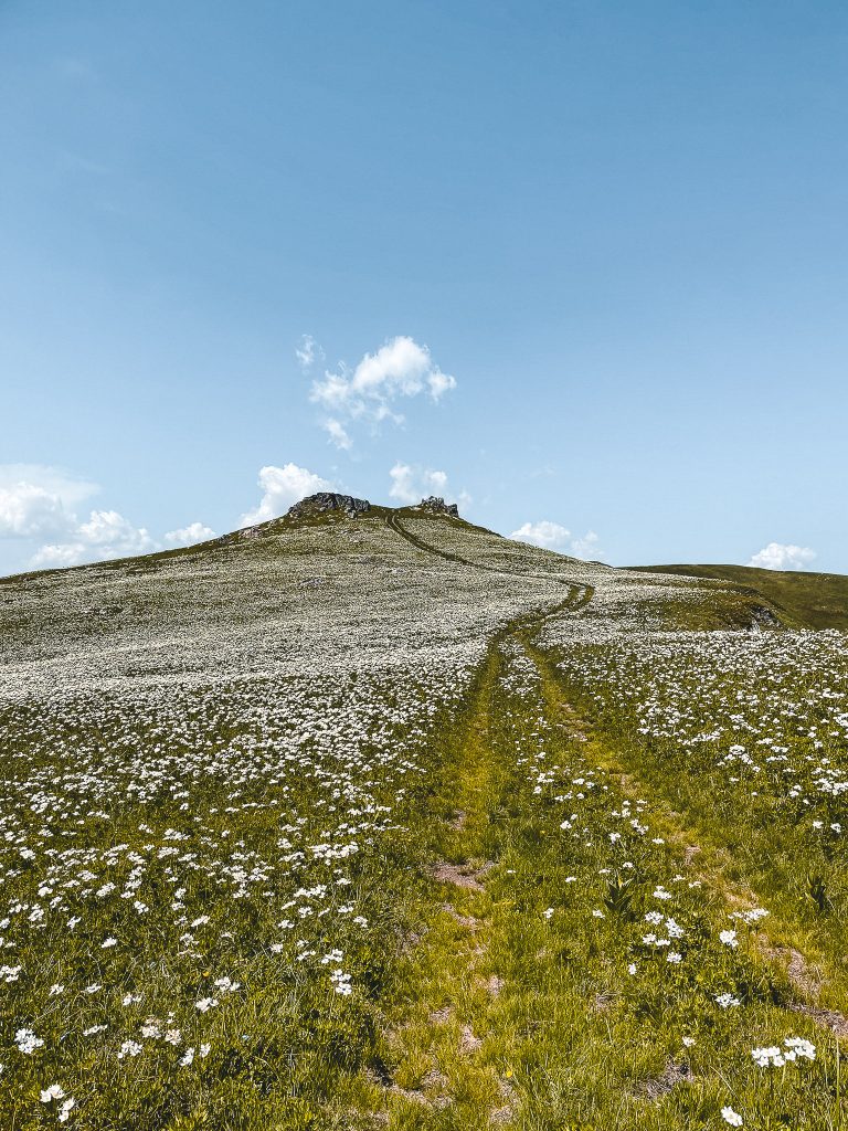
Hike up Jablanov vrh
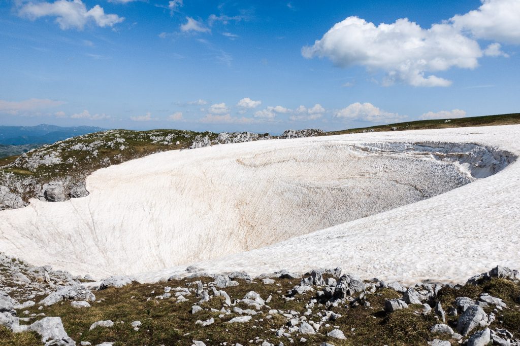
We want to stay a bit longer in Sinjajevina and decide to hike up Jablanov vrh. At 2277 meters, Jablanov is the highest mountain in Sinjajevina. The hike is only marked in the upper part; at least, we couldn't find any markings at the beginning and used Komoot to find our way. It's still early in the year, so we have to bypass small snowfields now and then, and the ascent is extremely steep. Unfortunately, just before the summit, a somewhat larger snowfield blocks our way. To its left, the mountain drops almost vertically, so we cannot climb the last few meters to the summit. Nevertheless, the view is spectacular, and the strenuous climb was 100% worth it.
Switchbacks to Kolašin
The winding road to Kolašin is unparalleled. We often can't make it around the tight corners without maneuvering. We're all the more impressed by two men with their ancient truck, which we encounter in one of the many hairpin bends. We feel a bit like we're in a documentary about the USA or Canada as the rugged mountains rise from the valley before us.
In Kolašin, we experience a bit of culture shock. Coming from the tourist-free, unspoiled Montenegro, we find ourselves in what is set to become the largest ski center in the country. Construction is everywhere, with Swiss-style chalets being built, roads being repaired and widened. It seems like an entire ski resort is set to spring up by winter. The mountains certainly promise plenty of skiing fun.
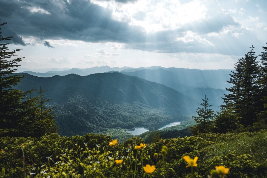
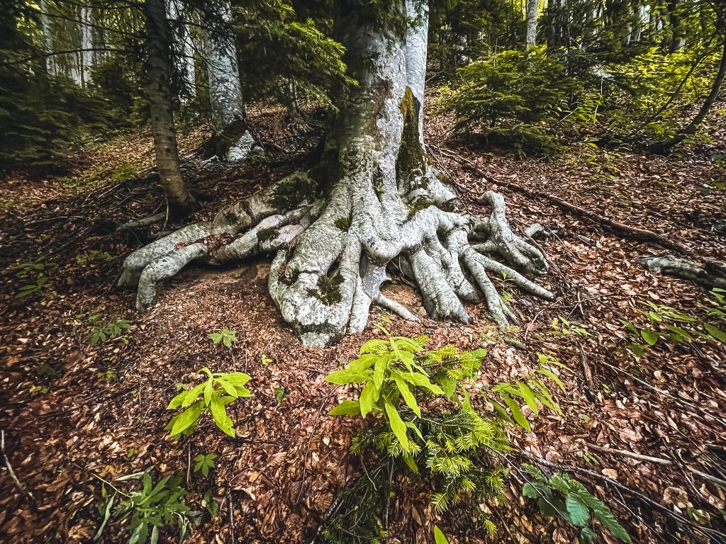
Biogradska Gora
From Kolašin, we drive to Montenegro's smallest national park – Biogradska Gora in the Bjelasica region. It is mainly known for its ancient forest – one of the last large primary forests in Europe. In addition, the park features breathtaking mountains over 2000 meters lush green mountain meadows where many katuns (alpine pastures) used to be found, and six glacial lakes. The largest, Biogradsko Jezero, lies in the valley at the park's entrance.
The park is one of the oldest protected areas in the world. King Nikola I placed the area under protection in 1878, just 14 years after Yosemite was declared the first nature reserve in the USA. In 1952, Biogradska Gora was declared a national park.
The park offers a unique variety of flora and fauna. In total, there are 2000 plant species and subspecies, some of which are endemic, found only here. Additionally, there are 150 bird species, numerous reptiles and amphibians, as well as bears and wolves. There are also around 350 insect species and many more animals. Among the 86 tree species, some trees are over 500 years old.
What is a primary forest?
A primary forest is an old forest untouched by human influence. The old tree structures with multi-layered canopies, widely varying tree heights and diameters, and different tree species provide a diverse habitat for wildlife. Additionally, old forests are more efficient at binding carbon than newly planted forests and fast-growing timber plantations, making forest conservation important for mitigating climate change.
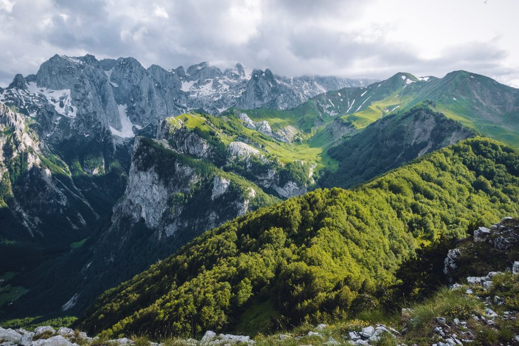
Prokletije Nationalpark
The drive to Prokletije via Komovi
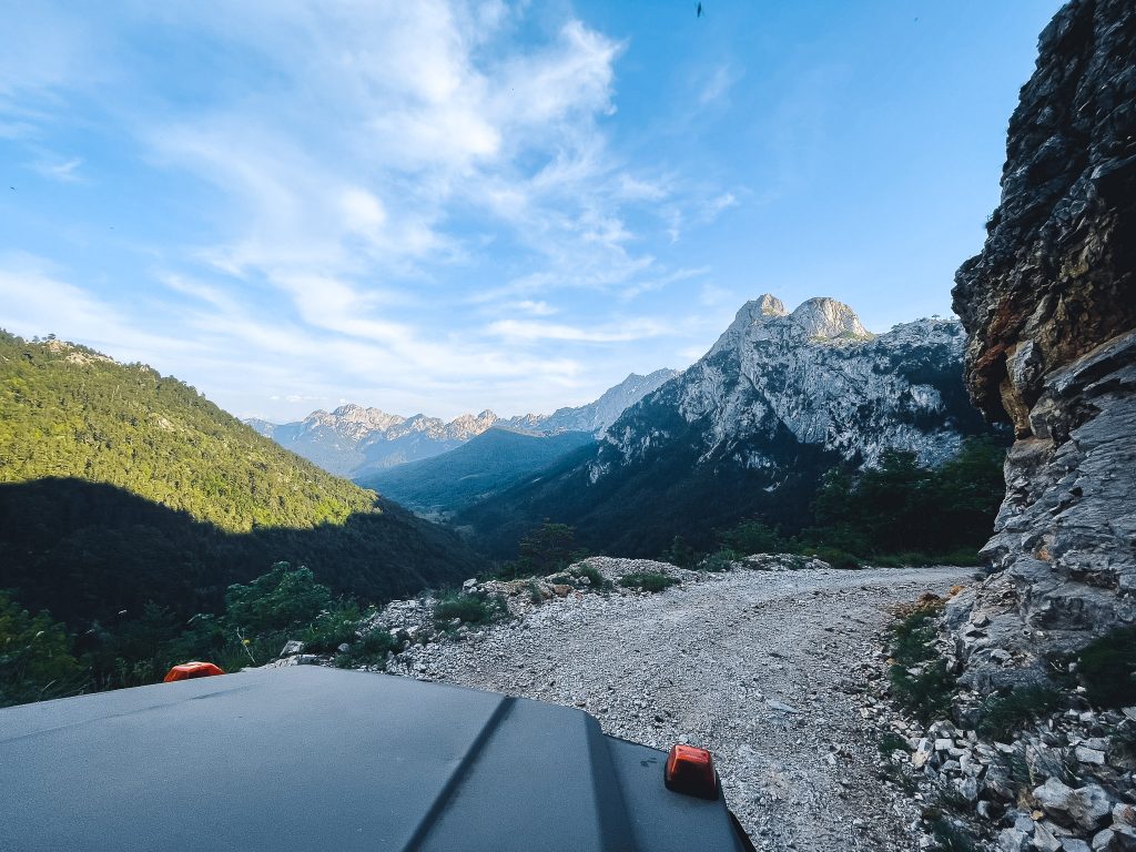
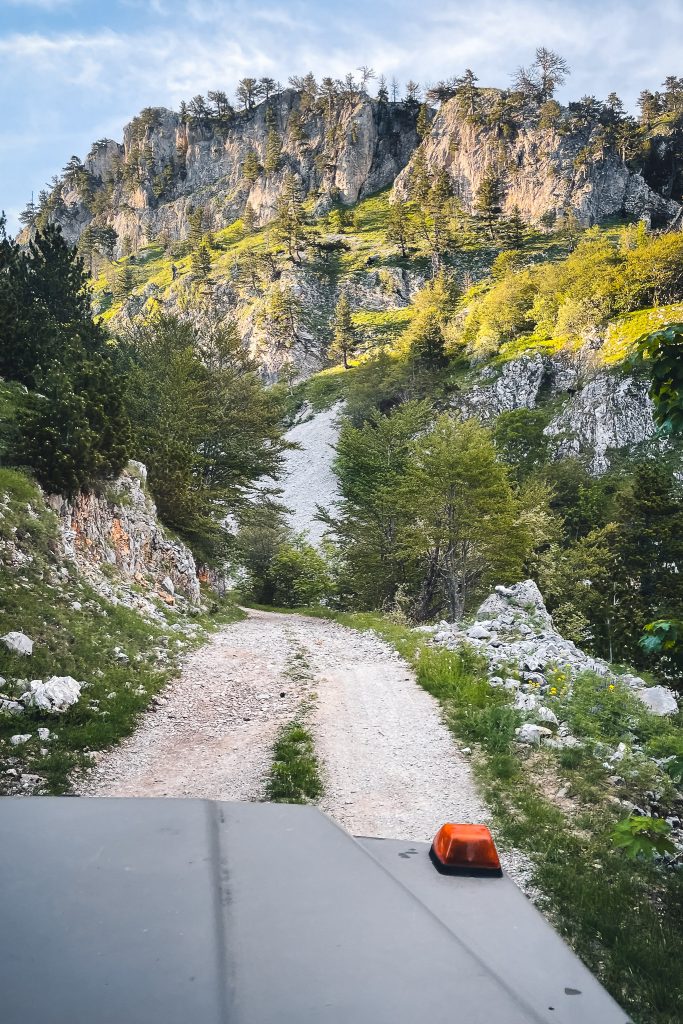
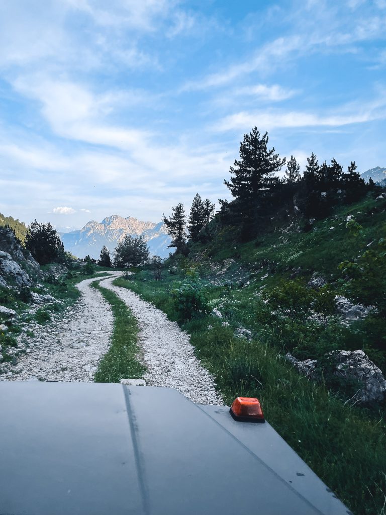
From Biogradska Gora, we drive to the next national park – Prokletije National Park, located in the far east of the country on the border with Albania. Using Google Maps, we have selected smaller roads instead of the main road. These lead us over hills, through forests, and many small villages. We are enchanted by the mountains rising on both sides and the rushing stream that accompanies us for several kilometers, sometimes on the left and sometimes on the right. When the majestic Komovi mountain range appears before us, we know that we definitely want to return here after our visit to Prokletije. Unfortunately, the weather will thwart our plans, and we will have to abandon this idea.
Plav and Hridsko See
Our starting point for Prokletije is Plav. The first thing we notice in Plav is the chaotic traffic, which is very different from what we have experienced elsewhere in Montenegro. Cars are parked in the middle of the street with their warning lights on while people quickly run errands. It's unclear who drives first, when, how, and where. The restaurant scene in Plav is also different. While restaurants are plentiful elsewhere in Montenegro, we find hardly any here. Instead, the town is covered with cafés where mainly men seem to gather.
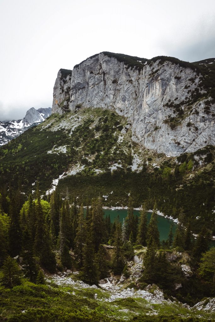
We decide to take the short hike to Lake Hrid, which, according to Komoot, takes just over an hour. We start late in the afternoon and leave our car at the parking lot at the trailhead. Instead, we pack the tent and decide to spend the night by the lake.
The hike to the lake follows a small trail through the forest. It is mostly flat. We encounter only a few hikers. Those we do meet are on the long-distance trail "Peak of the Balkans," which passes through here.
There isn't much space to pitch our tent by the lake, but we find a small spot a bit away from the lake at a little fire pit. The next morning, we enjoy our coffee in the morning silence and then hike back to the car.
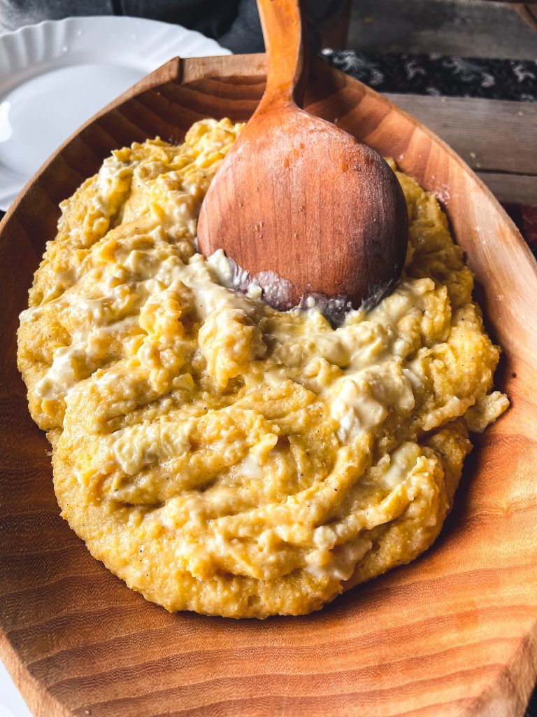
In a katun, we decide to stop for an early lunch. It has started to rain, making cooking in the car no fun anyway. We have Kačamak, a traditional hearty specialty from Montenegro's mountain regions. It's a real worker's meal – somewhat comparable to porridge. Of course, we can barely finish half the portion and decide to finally buy a food container at the next supermarket to pack any leftovers from now on.
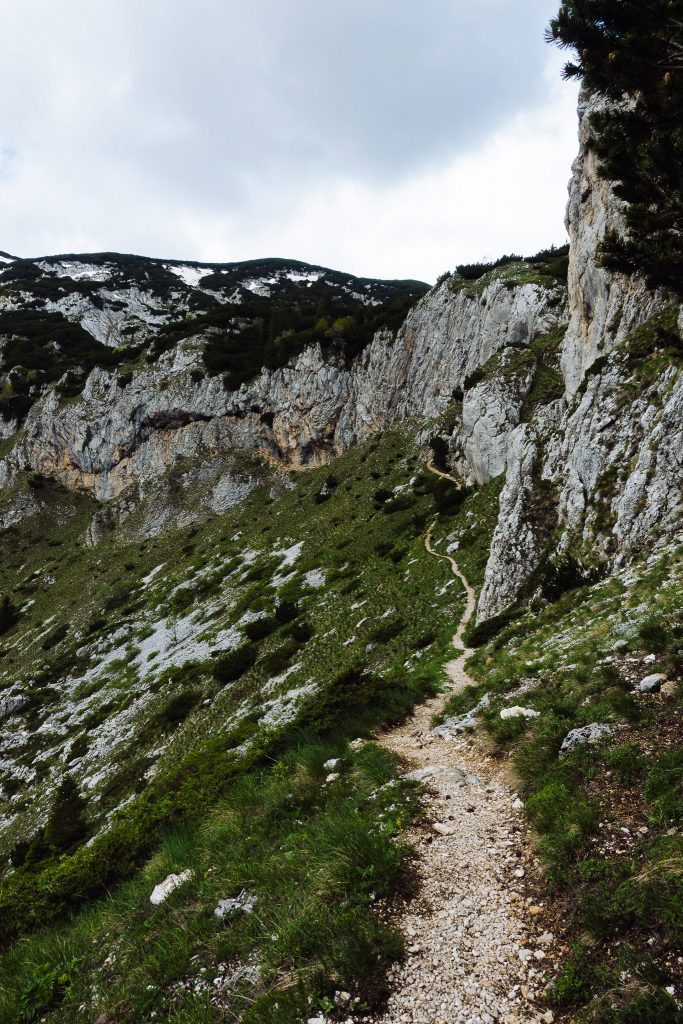
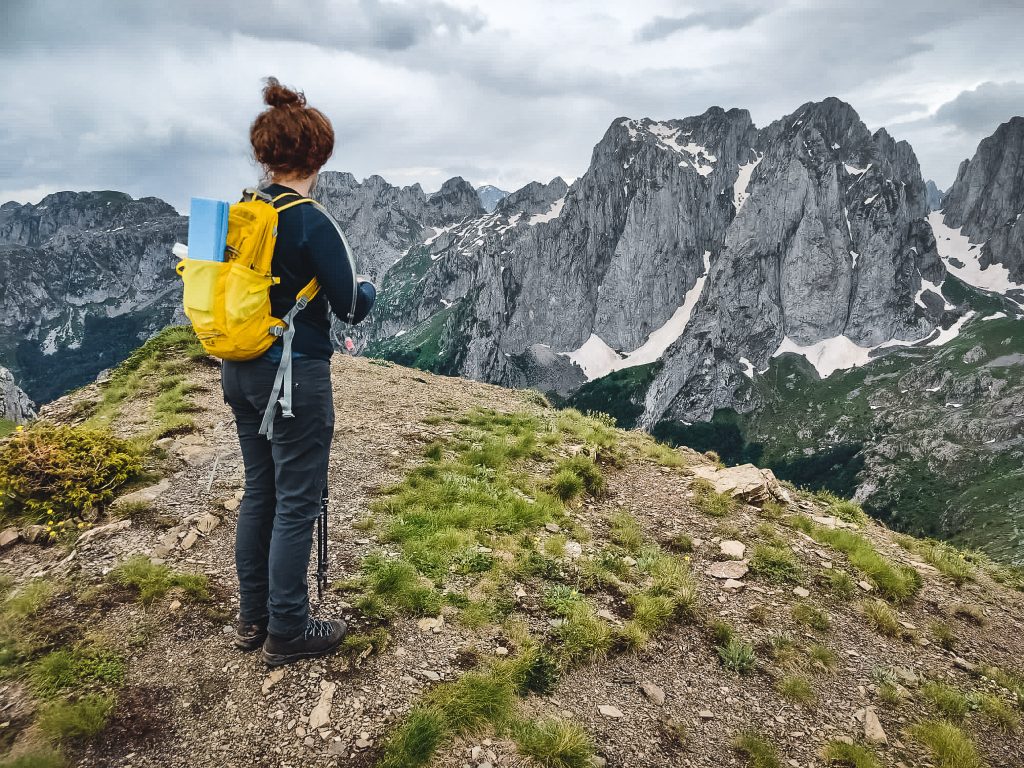
Hiking mountain Karaula
With full stomachs, we drive to the Grabaja Valley. From there, we have a breathtaking view of the surrounding 2000-meter peaks of Prokletije. We park in a meadow designated for campers and in the afternoon, we hike up the the mountain KaraulaThe narrow hiking trail winds up nearly 800 meters to the summit in several switchbacks. Due to the rain and the many leaves, the path is sometimes very slippery and not easy. Towards the end, the trail becomes slightly exposed. The last part includes a very steep section, with a rope available. At the summit, we have a breathtaking panoramic view of the surrounding peaks. We have it all to ourselves, as we didn't encounter anyone else on the hike. The weather seems a bit unpredictable, so we quickly start our descent.
3 Peak Tour – Talijanka, Popadija, and Volusnica
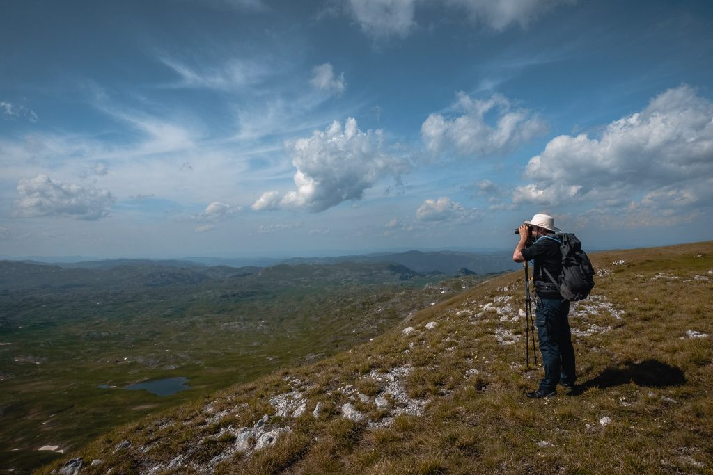
The weather forecast for the following day predicts rain and thunderstorms starting in the afternoon. Therefore, we set off early for our second hike. We want to do the 3 Peak Tour that leads to the peaks of Talijanka, Popadija, and Volusnica. The hike is 10km long and is 1100 meters in elevation. Halfway to the first peak, we take a breakfast break. On the one hand, we are hungry, on the other hand, we decide to take the time to observe the weather. After the short break, the weather has hardly changed, so we continue and reach the first peak around 11. Over a mountain ridge, we arrive at the second peak only a few hundred meters further.
We enjoy the view only briefly. The weather is closing in, the first thunder rumbles in the distance, and we head straight back down to the valley. The path back initially continues over the ridge. Not exactly the place for a thunderstorm. We take to our heels and sprint downhill. Most other hikers seem to care little about the approaching bad weather. Many stay on the peak, while others continue to hike upwards.
By the time we arrive at the bottom, it is already pouring rain. We pack our things and drive following the weather app, in search of the best weather. We set up our camp for the night in the mountains that we liked so much on the way to the national park.

Marika Gorge
Our next destination is a plateau directly opposite Sinjajevina. To get there, the road takes us along the Moraca and through the Marika Canyon. On the way, we pass the Danilov Most bridge and decide to make a detour. A narrow road leads to the small footpath to the bridge. The small bridge was built in 1858 by Prince Knjaz Danillo II Pestrovicas in memory of his mother. It offers a great view of the canyon and we liked it very much.
We walk back along the small footpath to the car and start looking for a campsite. With Park4Night, we quickly find one right by the Moraca. With a glass of wine, we enjoy the view of the wild river and the sunset. We are grateful for what we can see and experience here.
Lake Scutari and Wine Tasting
Lake Skadar is the largest lake in the Balkan Peninsula. In the southwest, the 1600-meter-high Rumija Mountain separates it from the Adriatic Sea. On the northeastern side, there is a vast and partly marshy area. Since 1983, the Montenegrin part has been designated as a national park, and in 1996, the Albanian part was also added. Lake Skadar is home to over 20 endemic animal and plant species and provides an important resting and breeding place for migratory birds from Northern Europe.
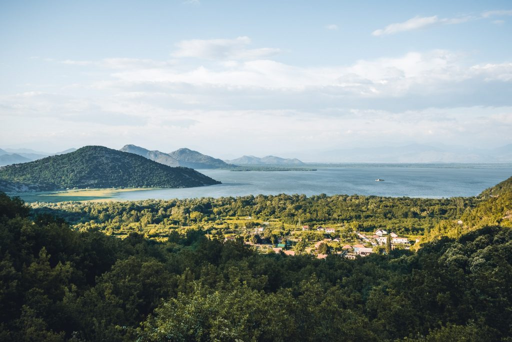
In the Mediterranean climate around Lake Skadar, some of Montenegro's best wines thrive. Many small micro-wineries cultivate their vines here. We book a wine tasting at Garnet Winery in Godinje. Godinje is a small village in the hills above Lake Skadar. For just 15 euros, we get to sample a white wine, a rosé wine, and a red wine. Additionally, there are 2 liqueurs and a grappa, along with plenty of good snacks perfectly paired with each wine.


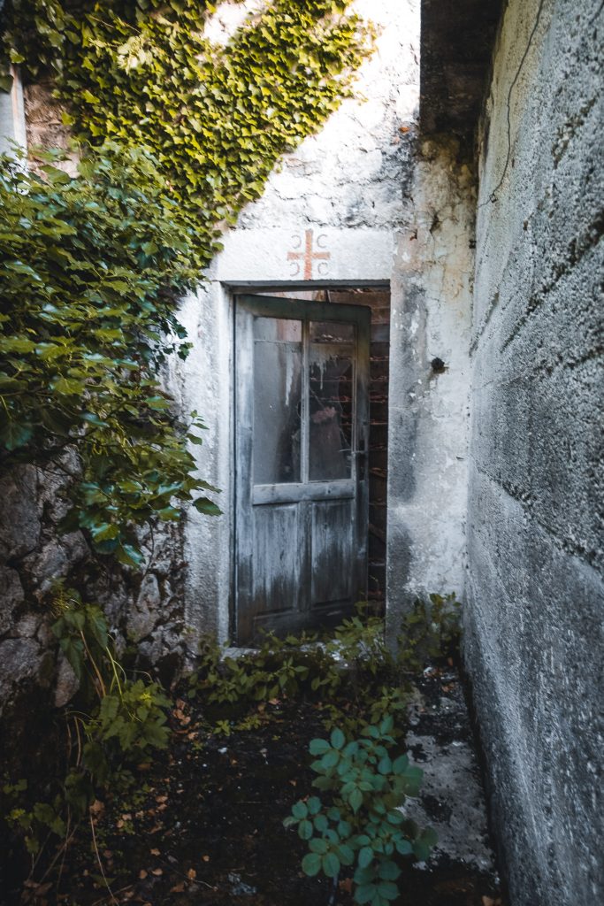
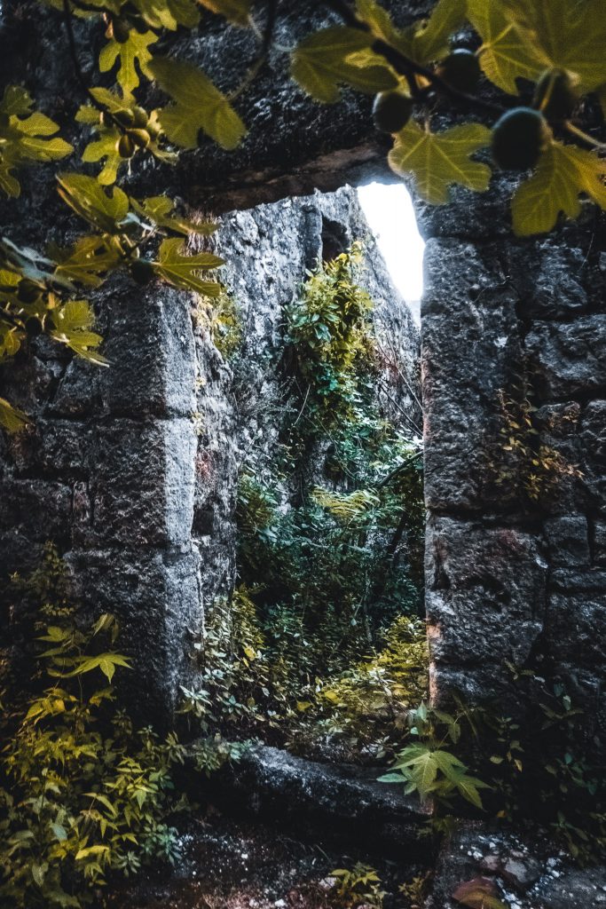
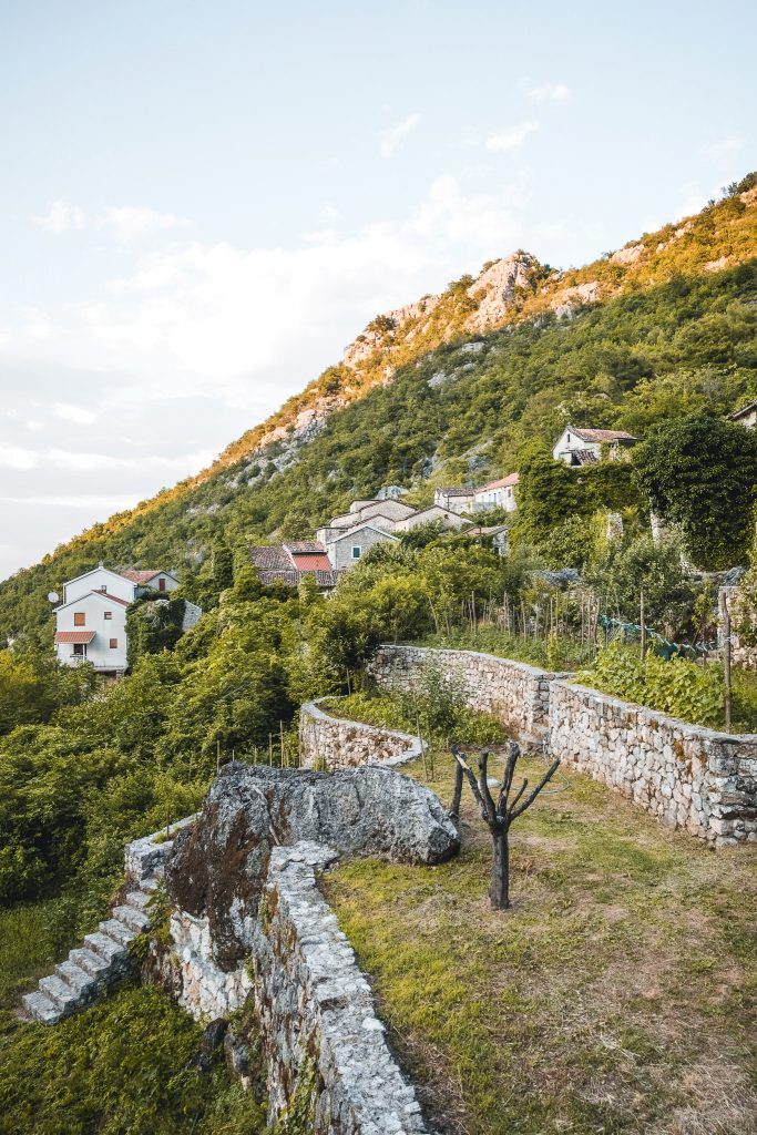
Nach der Weinprobe laufen wir durch die verschlungenen Gassen Godinjes. Das Dorf datiert mehrere Jahrhunderte zurück. Das älteste Haus ist über 600 Jahre alt und diente einmal als Sommerhaus für die königliche Familie. Heute leben nur noch wenige Menschen hier und diese auch nicht ganzjährig. Viele der Häuser sind über Passagen und Tunnel verbunden. Auch wenn heute viele der Häuser verlassen und zerfallen sind, erkennt. man doch noch immer die beeindruckenden Strukturen dieser alten Anlage. Immer wieder finden sich alte verwachsene Mauern entlang der Wege. Der Besitzer eines weiteren Weinguts in Godinje erzählt uns, dass es sich um Mauer der alten Terassengärten handelt, die schon sein einigen Jahrzehnten nicht mehr genutzt werden und zugewachsen sind. Nach einem letzten Glas Rotwein machen wir uns auf den Weg zurück zum Gästehaus.
Adriatic Coast
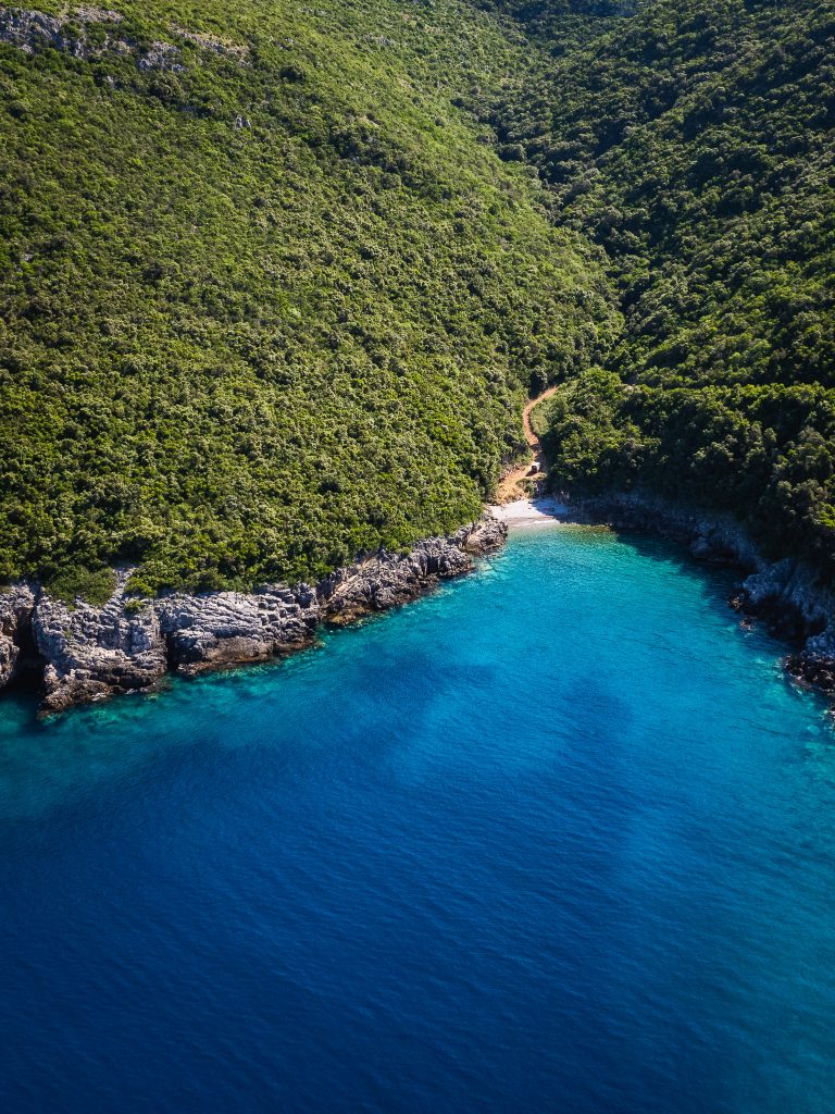
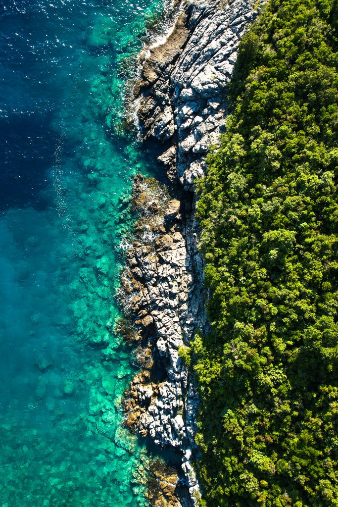
From Lake Skadar, we head back to the Adriatic to drive along the coast back to Germany. Before leaving Montenegro, we want to visit the beach one more time. We are not impressed by the crowded tourist spots, so we continue driving. Using Google Satellite, we find a small beach accessible by road and decide to try our luck there. The drive is bumpy, with bushes and shrubs encroaching on the path. Fortunately, we are not delicate with our car. The 6 km drive takes us more than half an hour, but in return, we are rewarded with a pristine beach. We decide to stay the night and go for a swim.
The next day, we head back towards Kotor. We feel a bit wistful at the sight of the old town and the bay, having spent no time here, but it’s just another reason to return. At one of the many mussel farms, we treat ourselves to a quick lunch and then drive along the coast back to Croatia.
Conclusion of Our Montenegro Road Trip
Our Montenegro road trip was truly enjoyable. Whether you’re looking for hiking or beach vacations, the country is versatile and has something for everyone. Since Montenegro is not very large, it’s especially well-suited for a two-week trip. If you're traveling by camper van, you'll find plenty of beautiful spots for camping and wild camping.