
The RP 34 connects Fiambalá in northwestern Argentina with the village of Las Papas, the Campo de Piedra Pómez, and Antofagasta de la Sierra. The 245.6 km route is considered one of the most beautiful off-road trails. Along the way, you can visit Termas Las Hornos, Termas Los Baños, and Laguna Aguada Alumbrera.
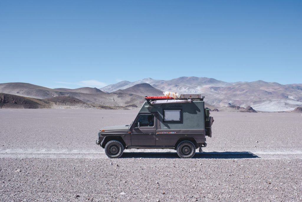
The route should only be undertaken with a suitable off-road vehicle and is dependent on the season.
Section 1: From Fiambalá to the Start of the Canyon
The first 64 kilometers lead from Fiambalá through the towns of Saujil, Palo Blanco, and Punta de Agua. The road is in good condition, partly paved. Therefore, the 64 kilometers are quickly covered. They are rather unspectacular and can be traveled fairly quickly. Now the road turns left. After 3 kilometers, you reach the canyon and the riverbed through which you get to Las Papas.
Section 2: Through the Riverbed to Las Papas
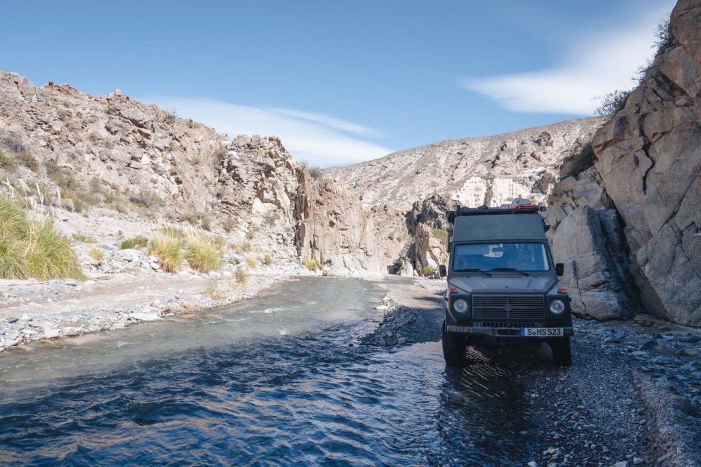
From here, the road leads through a riverbed for 25 kilometers. Approximately 30-40 river crossings must be made. The course changes from year to year or after heavy rainfall. Currently, there is a construction site here. According to iOverlander, it seems a dam is being built. To be safe, we ask one of the workers if the road is passable. "No problem," we get as a response.
He is right. The 25 km through the canyon pose no problem for our Puch. However, the vehicle should have sufficient ground clearance and reasonably steep approach angles. The river crossings at the end of April 2024 are not particularly deep. We still have plenty of clearance. However, if it has been raining recently, it might make sense to test the depth beforehand.
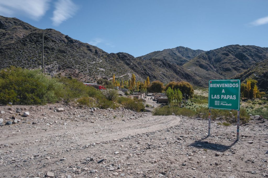
Once you have crossed the riverbed, you find yourself in the small village of Las Papas. We are amazed at how people live in such remote places. Although it is not far in terms of kilometers, the riverbed is the only connection to Fiambalá. Depending on the season and weather, this can be impassable.
Section 3: From Las Papas to the Termas Las Hornos
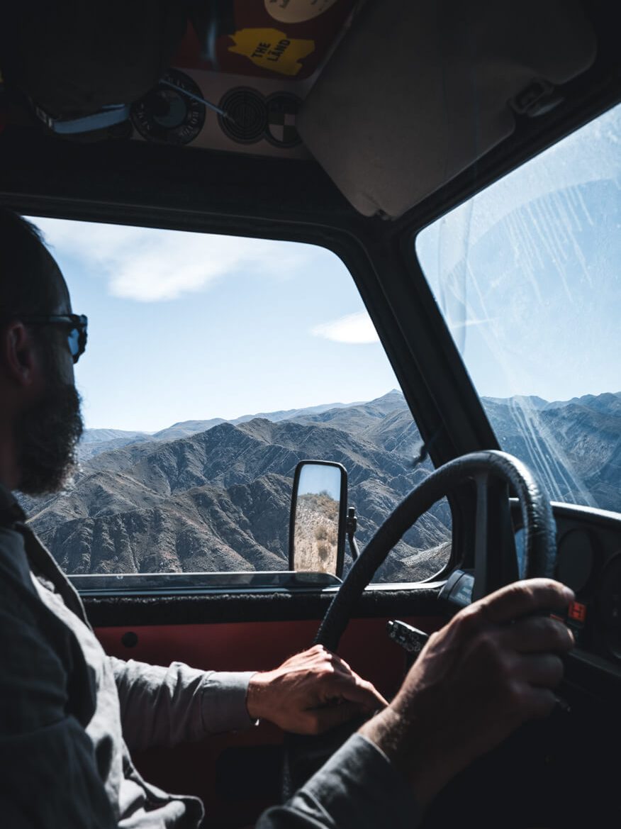
From Las Papas, the route almost continuously ascends. Over a short but steep section, you leave the river valley via several very tight switchbacks. The path is narrow and offers little room to pass oncoming traffic. After 3 kilometers, the road reaches a pass at 3000 meters, before descending 1.5 kilometers back down to 2900 meters to a small river. We spend the night at this small stream.
We set off early the next morning to bath in the Termas Las Hornos before breakfast. From 2900 meters, the route continuously, though not steeply, ascends for 11.5 kilometers to 3700 meters. The view is consistently spectacular. There, the road continues to the right towards Campo de Piedra Pómez. To the left, a turnoff leads to the Termas Las Hornos.
From the turnoff to the Termas Las Hornos
The Termas Las Hornos are located at 3500 meters and are a small paradise. From the turnoff, a narrow road descends 3 kilometers to the Termas. The short route is a bit adventurous. It is narrow, with very tight switchbacks. Even we have to maneuver at three curves to get around. In places, the curves lean towards the downhill side. Turning around on these 3 kilometers is hardly possible.
Once you arrive at the bottom, you will find a few old ruins. In theory, you can park your car here and walk the last 500 meters on foot. Alternatively, the road continues over a few short, steep meters and a tight downhill curve up to the Termas. After that, you have made it. There is a small designated area for parking.
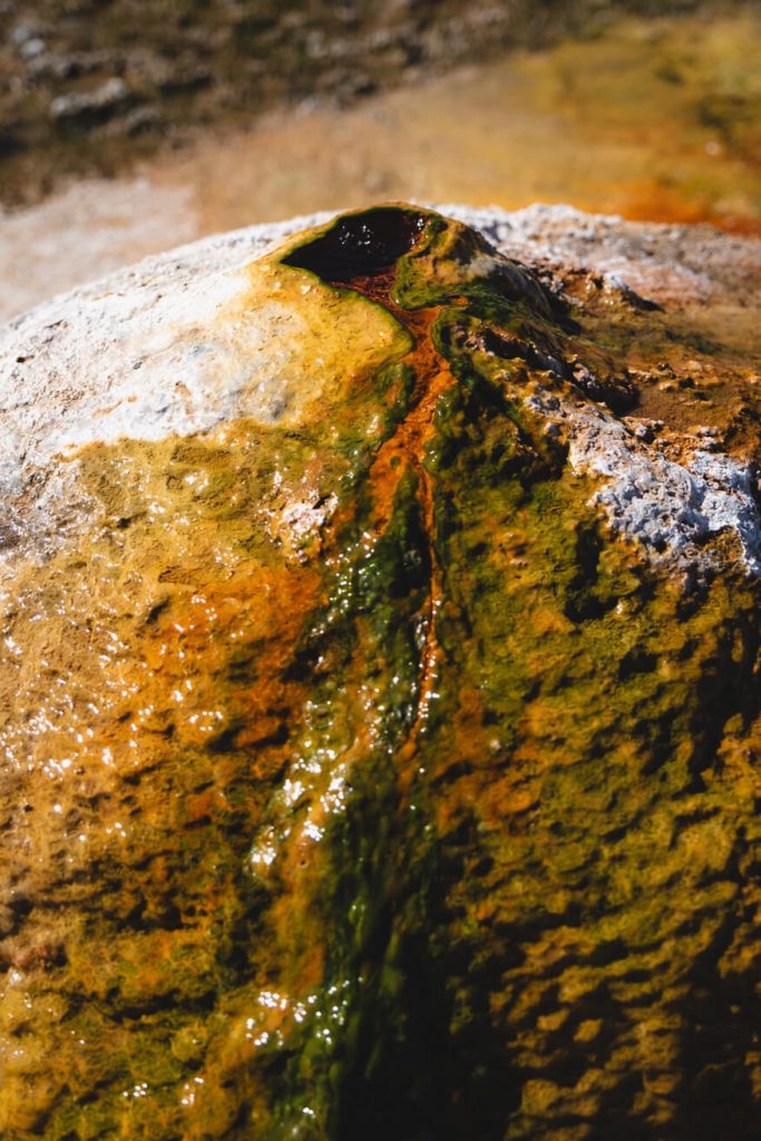
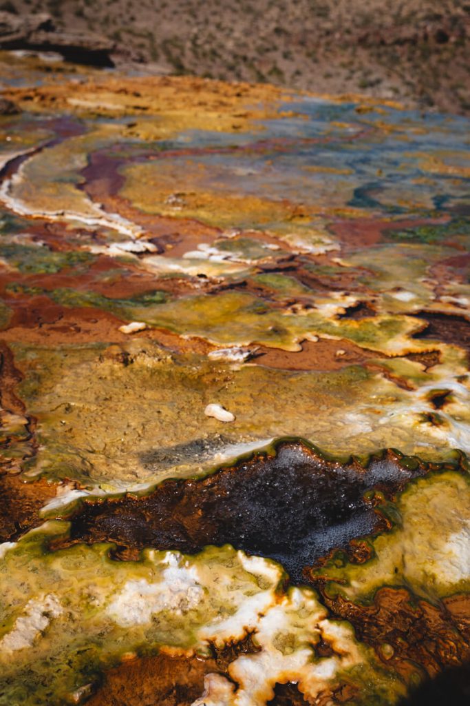
The Termas Los Hornos
The Termas are completely natural. There are no pools or infrastructure. Hot water bubbles or flows from many spots, mixing with the small stream to create the perfect bathing temperature. This stream is more like a brook. You need to search a bit to find a good bathing spot. If you walk a little to the left, you will find a small "pool" that comfortably fits two people. Letting the water from the small waterfall run down your back immediately gives you a jet-like feeling, just like in a thermal bath. Very relaxing!
We have the hot springs entirely to ourselves. Those who are already acclimatized can easily find a place to sleep here at 3500 meters. We are not acclimatized, and the weather forecast isn't great, so we prefer to get past the key point of the tour today in case we need to turn back. So, we dry off and get back into the car.
Section 4: From the Turnoff (Termas) to Laguna Aguada Alumbrera
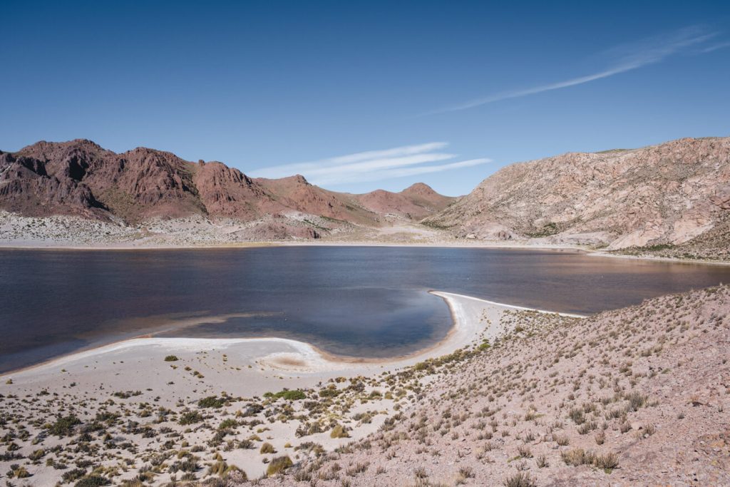
From the Termas, you drive back to the turnoff and take the road towards Campo de Piedra Pómez. The landscape changes quickly. The green mountain scenery transforms into a vast sandy desert. We almost feel as if we are driving on the moon. After 3 kilometers, you reach Laguna Aguada Alumbrera at 3720 meters. We don't see any flamingos here. This would also be a good place to spend the night if you are already acclimatized. However, it’s best if the wind isn't too strong; otherwise, you'll be camping in a sandstorm.
Section 5: Laguna Aguada Alumbrera to Campo de Piedra Pómez
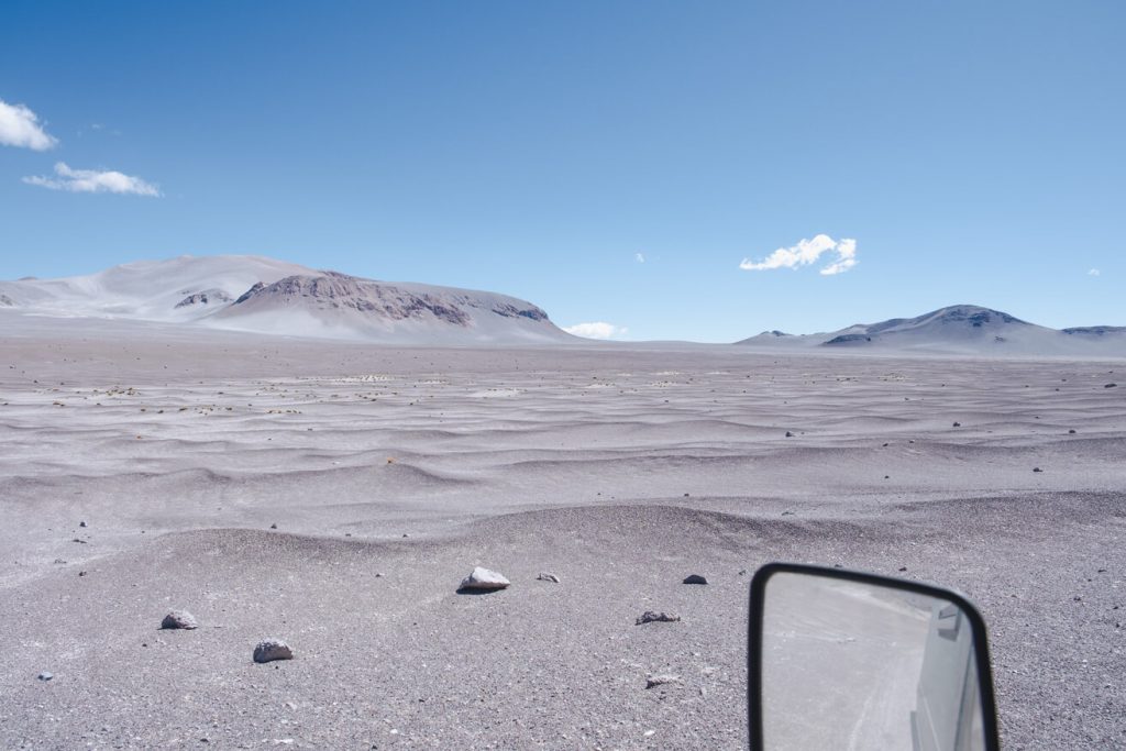
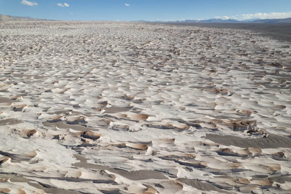
We continue driving. From here, the road becomes increasingly sandy. The last green patches disappear, and the impression of a lunar landscape intensifies. Soon, all you can see is white sand, which glistens in the sunlight.
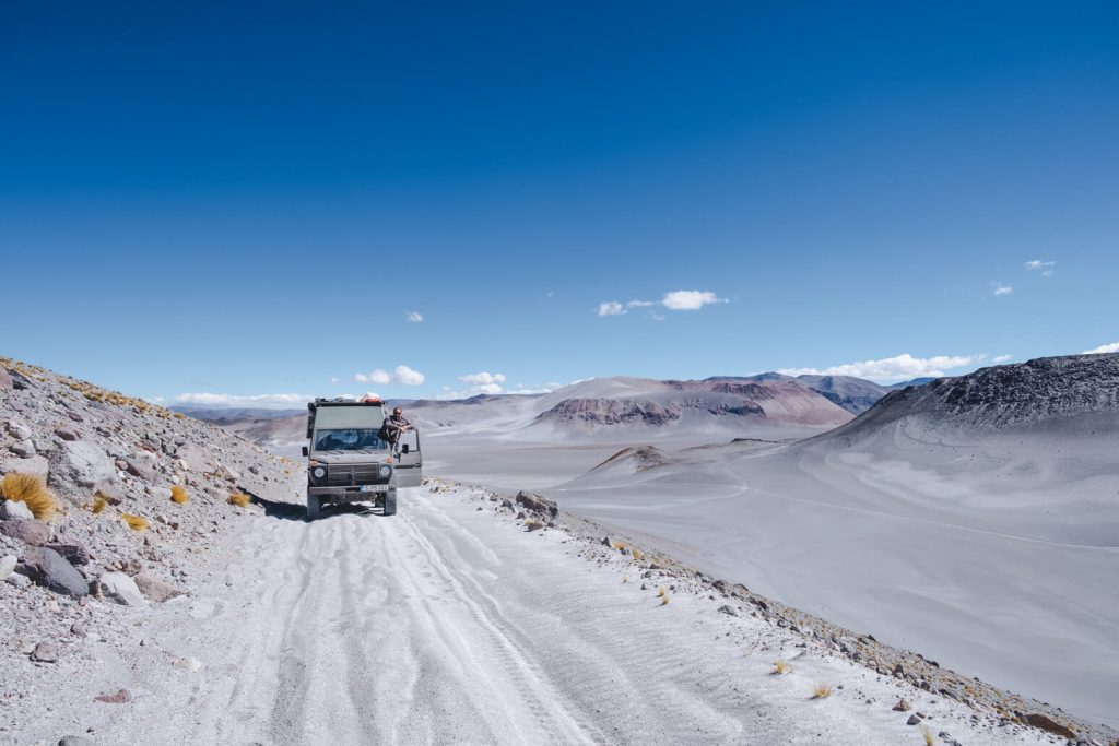
Key Point: Soft Sand at Over 4000 Meters
It's not far to the key point of RP 34: a steep ascent in soft sand at over 4000 meters. The comments on iOverlander almost made us lose hope that our Trude could make it, even with the low gear engaged. The engine just isn't the strongest. At over 4000 meters, you can really feel it.
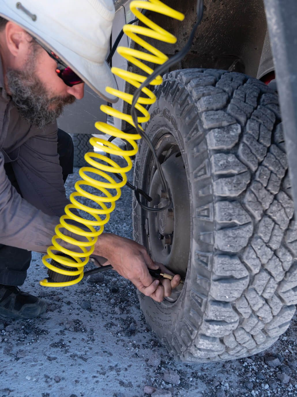
However, the challenge begins 3 kilometers before the marked spot on iOverlander. We are just above 4000 meters. The slope ahead is not long but very sandy and steep for 4000 meters. Here, everyone finds their preferred path. In an area 100 meters wide, you can see countless tire tracks. We try to find the flattest spot, attempt it 3 times at two different points, but have to roll back down the hill each time. We let quite a bit of air out of the tires. Fourth attempt: With deflated tire pressure, it's no problem at all. We make it without any issues.
From the Key Point to Campo de Piedra Pómez
From here on, the route is no longer a problem. About 14 kilometers from the lagoon, the road splits for a few kilometers. According to information from iOverlander, most people seem to take the left route, which is described as the difficult sandy path. However, the latest comment on iOverlander also mentions that the right route is less sandy, has more stones on the road, and is thus the easier option. To our surprise, there are even signposts clearly directing towards the right route. Perhaps they are new? We don't know. We take the right path. The route is easily manageable. The biggest challenge remains the hill 3 kilometers back. After that, our Puch handles everything smoothly, and even that hill was no problem with deflated tire pressure.
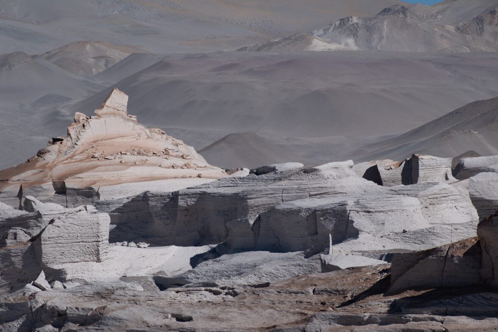
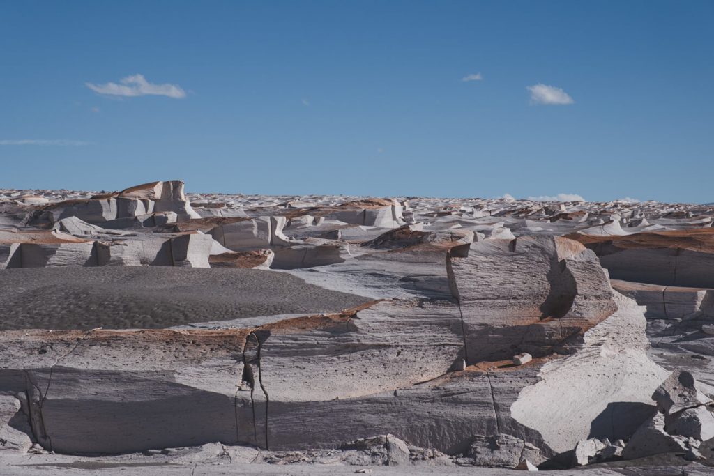
At an altitude of 4300 meters, we enter the Campo de Piedra Pómez nature reserve, a collection of pumice stone formations. With each kilometer, more of these pumice giants emerge from the sand. They look a bit like waves until only a few meters of sand separate them. It’s a glimpse of another world. The route through the nature reserve is about 40 kilometers until you reach the main parking lot.
Section 6: Campo de Piedra Pómez to Antofagasta de la Sierra
From Campo de Piedra Pómez, the road turns into a relentless washboard track. In some places, we crawl along at 10 km/h over the bumpy terrain. There is hardly any way to avoid it. Whereas before we could choose our own path, here it’s almost impossible due to the piled-up side elevations. We spend the night at Laguna Carachi Pampa and then continue to Antofagasta the next day. From Campo de Piedra Pómez to Antofagasta de la Sierra is about 70 kilometers if you drive directly. Fortunately, not all of the 70 kilometers are washboard tracks.
Tour Data Overview
Total Distance: 245.6 kilometers (Fiambalá – Antofagasta de la Sierra)
Highest Elevation4300 meters at Campo de Piedra Pómez
Total Ascentmeters
Total Descentmeters
Terrain Mix of paved roads, riverbeds, sandy desert, and washboard tracks
Vehicle Requirements Suitable off-road vehicle with good ground clearance and steep approach angles
Points of Interest:
- Termas Las Hornos: Natural hot springs
- Campo de Piedra Pómez: Unique pumice stone formations
- Scenic desert and mountain landscapes
- Laguna Aguada Alumbrera
Safety Considerations and Challenges:
- Check weather forecasts
- Acclimatization to high altitudes recommended
- Ensure the vehicle is well-equipped for off-road conditions
- Numerous river crossings (30-40) – test river depths if there has been recent rainfall
- No cell phone reception along the entire route
- Steep, sandy ascents over 4000 meters (note that every vehicle loses significant power at these altitudes)
- Narrow, winding switchbacks
- Possibility of sandstorms / poor visibility
2 Comments
Hallo an Euch,
Habe euch gerade gefunden und freue mich, denn ihr habt das gleiche Auto, wie wir. UNser Puch wird im Juli verschifft nach Montevideo.
HAbt ihr einen Tipp, was wir an Technik und Erstzteilen mitnehmen sollten? ISt euch etwas kaputt gegangen? war das Auto in manchen Situationen überfordert?
Würde mich sehr freuen, wenn ihr mir ein paar Tipps geben könntet.
beste Grüße,
SAbine und Peter
Hallo Sabine und Peter,
das freut uns sehr zu hören! Der Puch ist ein tolles Reisefahrzeug.
Hier sind unsere Erfahrungen bezüglich Technik und Ersatzteilen:
Ersatzteile & Reparaturen: In Chile mussten wir die Benzinpumpen austauschen, als eine davon den Geist aufgab. Wir hatten zum Glück zwei dabei. Da der Puch zwei Pumpen hat, sollte man fast immer beide wechseln, wenn eine ausfällt. Wir haben auch den Kraftstoffdruckspeicher gewechselt (den haben wir tatsächlich in Bolivien gefunden).
Wir haben unterwegs ein anderes Paar mit einem Puch getroffen. Bei ihnen ging die Wasserpumpe kaputt und sie mussten extra eine aus Europa bestellen.
Wir mussten außerdem unseren Mengenteiler austauschen. Das lag aber nicht am Teil selbst, sondern an einem schlechten Kraftstofffilter, den wir in Peru eingebaut hatten. Der Filter ging kaputt, und Schmutz gelangte in den Mengenteiler, den wir dann aus Europa bestellen mussten. Nehmt am besten genug Kraftstofffilter mit.
Was wir dabei hatten: Wir hatten Radlager, Benzinpumpen, diverse Filter (die richtigen sind vor Ort oft schwer zu finden), Zündkerzen (die gab es fast überall) und einen Zahnriemen mit Spanner dabei. Man kann natürlich nicht alles mitnehmen, und das Risiko, dass man etwas aus Europa oder den USA bestellen muss, bleibt.
Werkzeug: Nehmt auf jeden Fall Spezialwerkzeug mit. Ich denke da vor allem an das Werkzeug zum Wechseln der Radlager (Nutmutternschlüssel). Wir mussten die Lager zwar nicht wechseln, aber wir haben das Spiel einmal nachgestellt. Wir sind vor der Reise das Handbuch durchgegangen und haben eine Liste mit Schlüsseln und Werkzeugen erstellt, die für potenzielle Reparaturen nötig sind.
Leistung: In großen Höhen hatte das Auto etwas zu kämpfen. Da braucht man die Untersetzung und viel Geduld. Oft hätten wir uns in den Anden etwas mehr Leistung gewünscht. Aber insgesamt lief der Wagen super und wir sind über 50.000 km gefahren. Er kommt fast überall durch und wir hatten verhältnismäßig wenige technische Probleme.
Wir wünschen euch eine fantastische Reise!
Viele Grüße, Sarah und Mats
P.S. Verpasst auf keinen Fall die RP34, das war eines unserer Highlights auf der Reise. 🙂